
Your Fields, Seen from Space
OpenCrop combines Sentinel-2 and Planet satellite imagery with AI to give you instant crop health insights, weather alerts, and agronomic advice — no complex tools required.

Farming Without Guesswork
Traditional farming relies on intuition. OpenCrop replaces uncertainty with data.
Without OpenCrop
- Crop stress is noticed only when visible — losses have already started.
- Frost, drought, or storms arrive without warning.
- Paper records can't reveal seasonal patterns.
- Disease spreads unchecked until it's too late.
- No way to measure profitability per season or field.
With OpenCrop
- NDVI + 9 other vegetation indices detect stress weeks early.
- Smart alerts warn you 24-48 hours before risky weather.
- Soil analysis with 14 properties across 6 depth layers.
- AI photo diagnosis identifies diseases in seconds.
- Automatic P&L per season, per field.
- Mobile app + WhatsApp integration for instant alerts.
- Fast IoT sensor integration for real-time field data.
- Location-based crop diseases & pest detection worldwide.
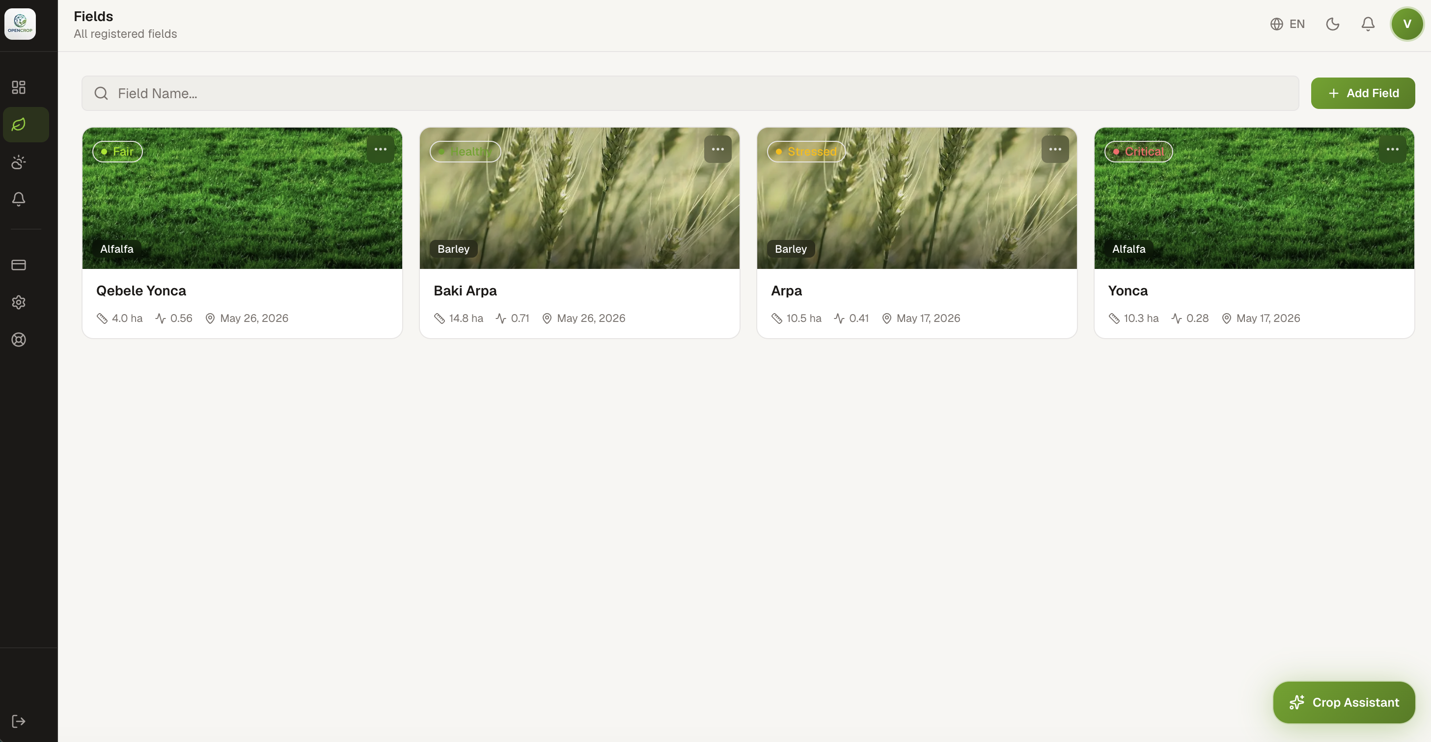
Everything in One Place
From satellite analytics to AI-powered advice — manage your entire farm operation from a single dashboard.
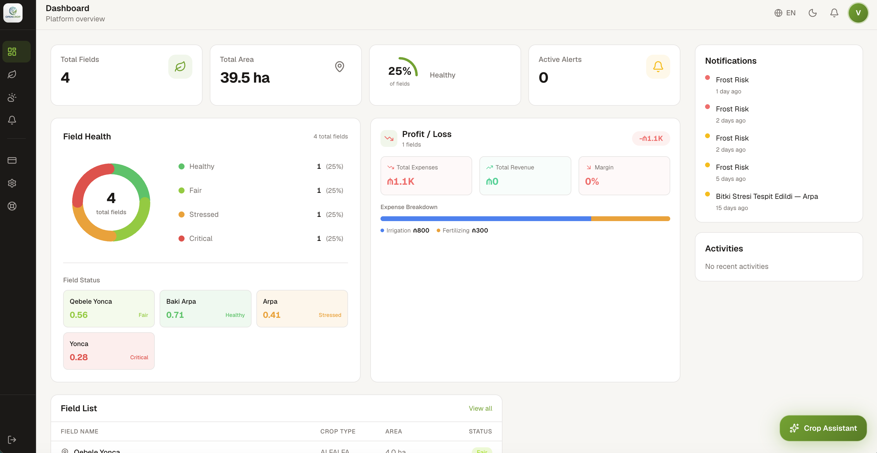
Track all your fields, health status, alerts and activities at a glance.
Up and Running in Minutes
Draw Your Field
Use the interactive map to outline your field boundaries. Area is calculated automatically.
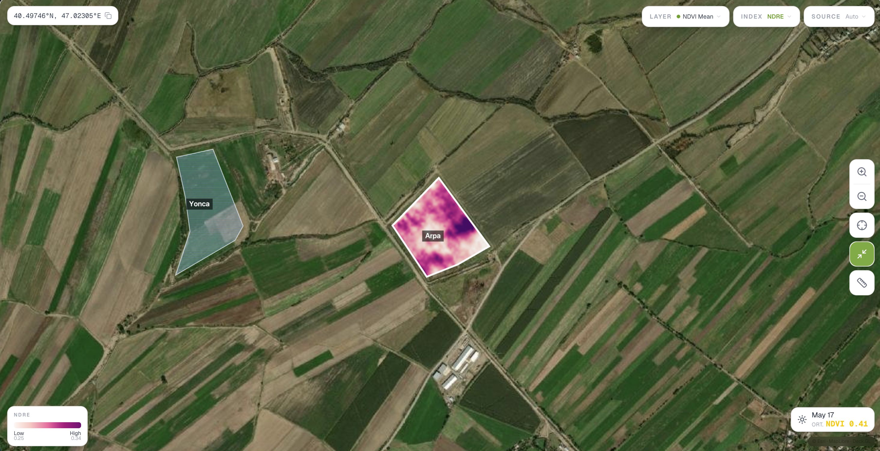
Get Satellite Insights
We process Sentinel-2 and Planet imagery daily. AI analyzes health, detects anomalies, and generates clear reports.
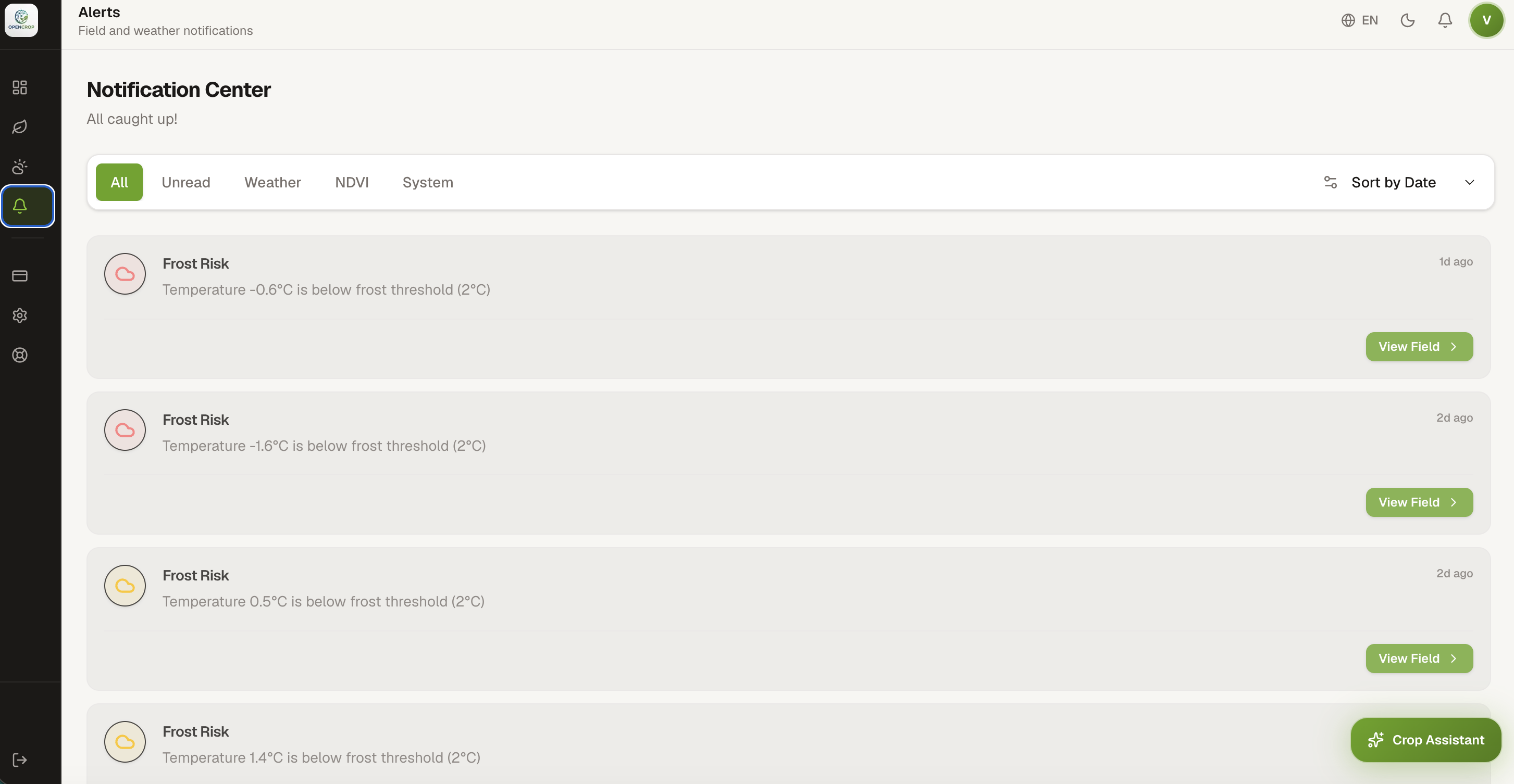
Receive Smart Alerts
Get notified before frost, drought, or extreme weather. Act early, protect your harvest.
Try OpenCrop Completely Free
All premium features — satellite imagery, AI assistant, risk alerts, and up to 40 fields — are completely free during our beta.
No credit card required. Full Business Plan access.
Answers to Your Questions
We use Sentinel-2 (10m resolution) and Planet (3m resolution). Our AI analyzes even small parcels and gives you actionable insights.
Satellite imagery is updated daily during the beta. You get full access to both Sentinel-2 and Planet data.
The platform supports all crops worldwide with location-based disease and pest detection. Optimized for wheat, barley, corn, sunflower, cotton, vegetables, and more.
All data is stored on European servers in compliance with EU standards and GDPR.
Yes. During the beta, all Business Plan features are available at no cost. No credit card required.
Yes, our mobile app for iOS and Android is coming very soon. The web platform works great on mobile browsers too.
Yes. During the beta you can add up to 40 fields and 500 hectares of total area.